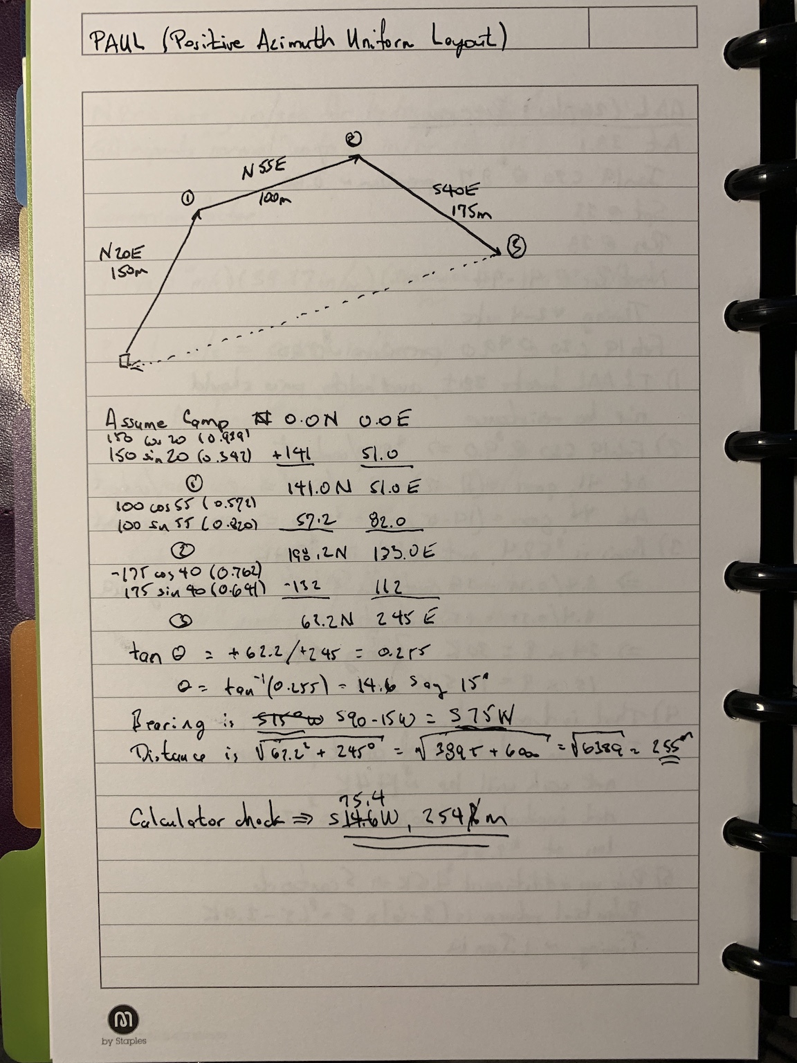
The approach is based on the conversion of bearing (or azimuth) and distance to northing and easting coordinates. When I learned to survey (with a 20-second transit, a 100-foot steel tape, a dumpy level, and a three-section level rod) this was how we did the calculations. Therefore, I wondered if I could use a slide rule to do the trigonometry, squares, and square roots required to obtain an arithmetic solution. The figure is the result of that with one error — I forgot to convert the angle (from the east-west axis) to a bearing (from the north-south axis). The error is corrected in the figure.
I also ran the solution with a hand calculator. (I used an HP-35s for the vector addition.) The calculations can be done with a pencil, piece of paper, and a slide rule. I used a Versalog 1461 (six-inch version of the Versalog slide rule). The solution is plenty good enough to return to camp.
That was fun.